Covington Central Riverfront
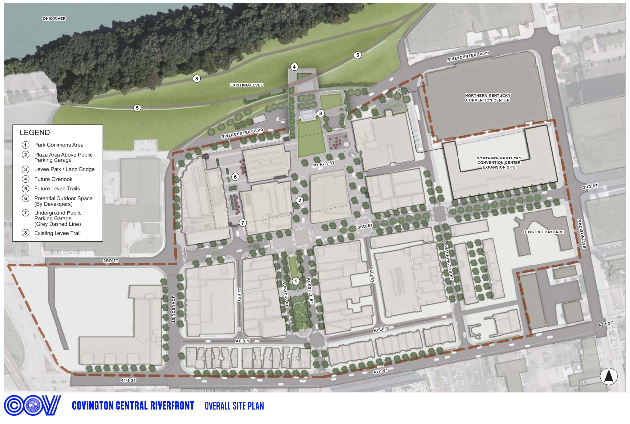
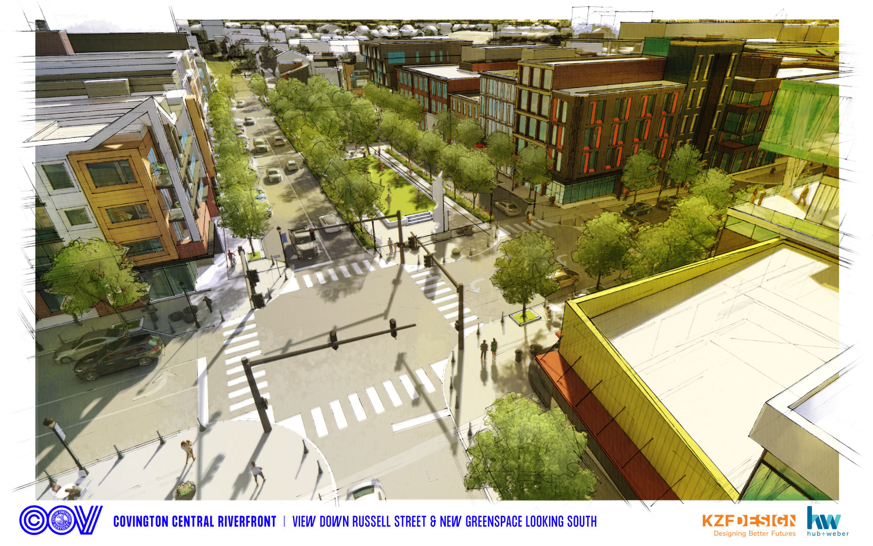
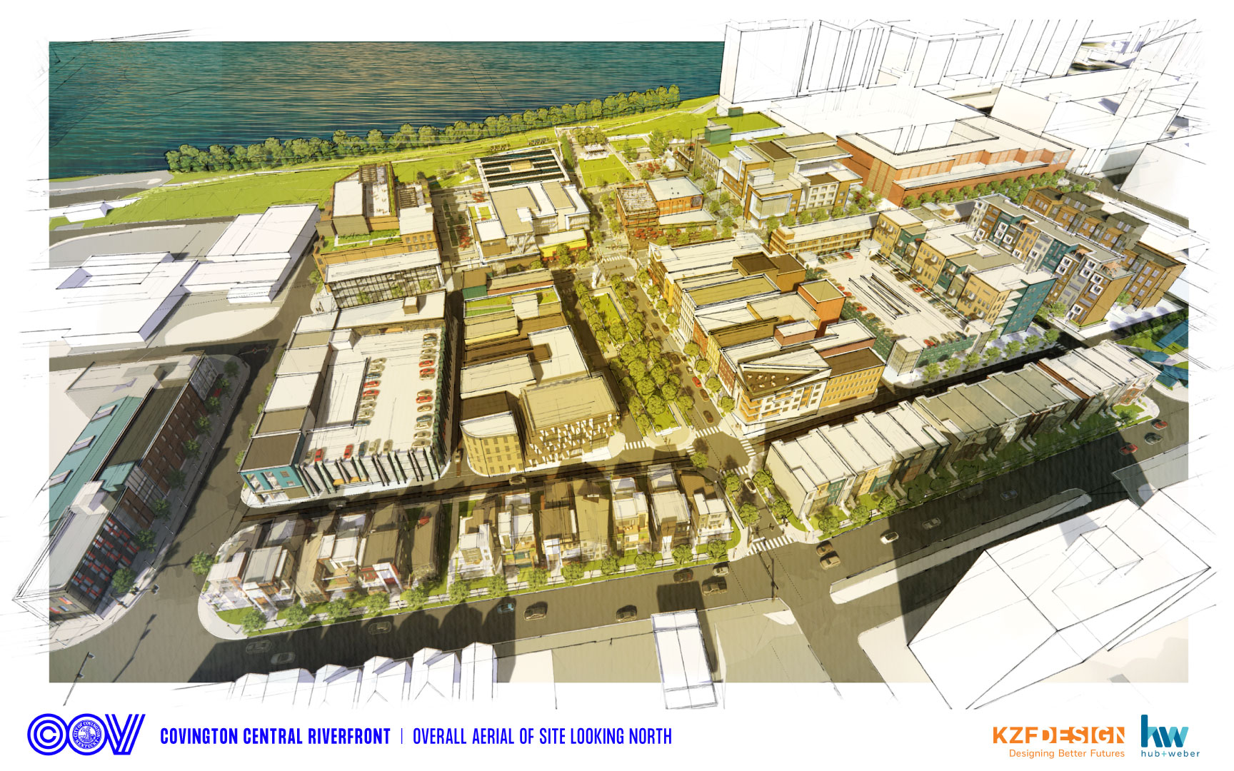
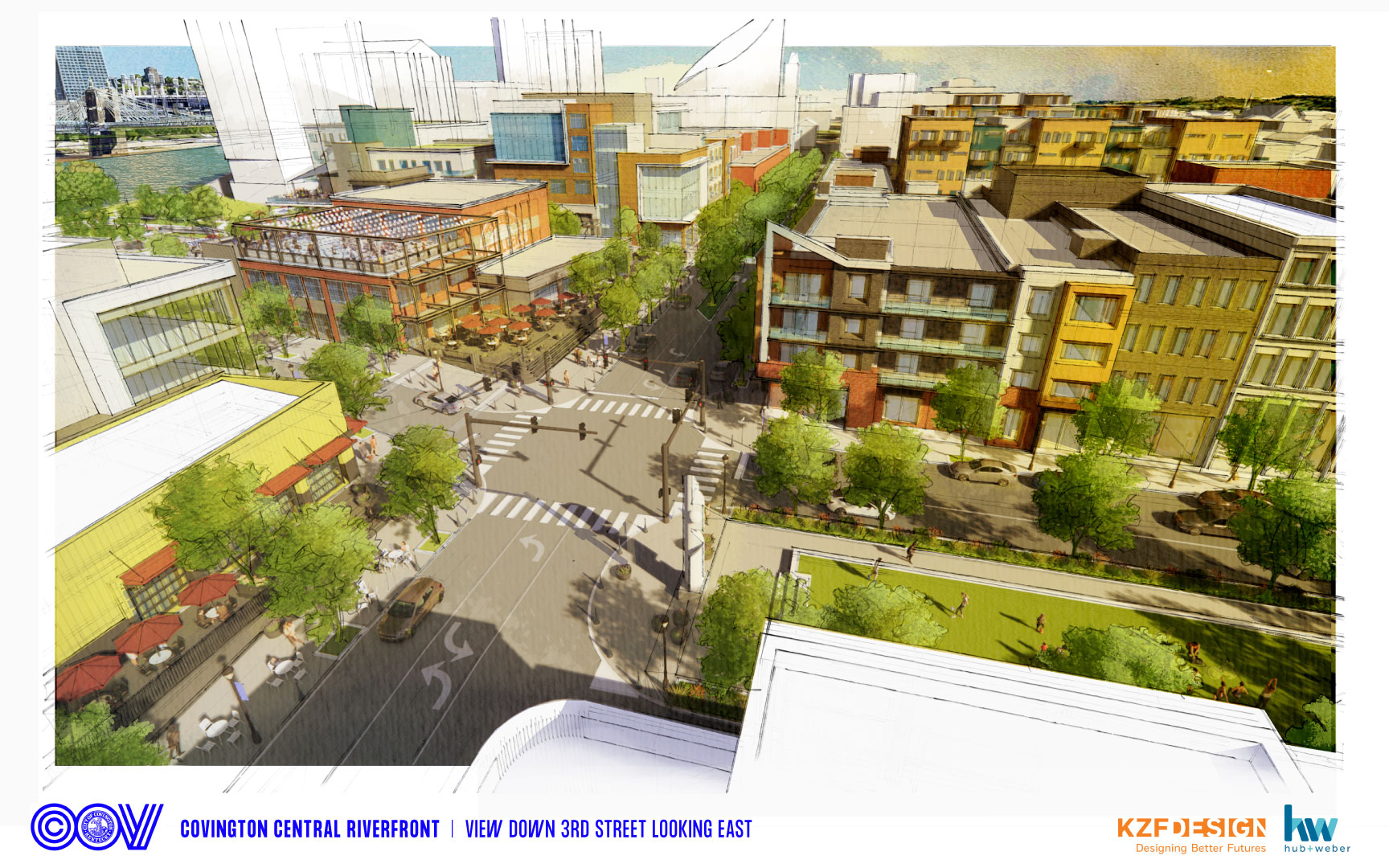
Covington’s vision is a restored street grid as the framework for a new mixed-use neightborhood with office, residential, retail and public spaces.
Latest News

More News
Plans
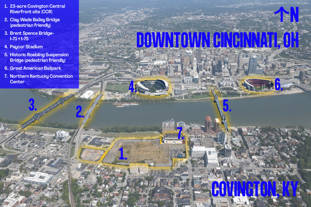
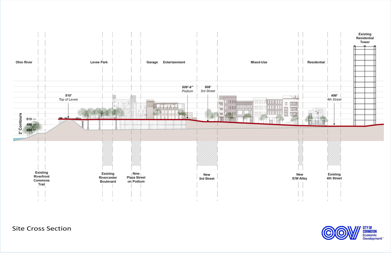
The 23-acre site is bordered by the Ohio River to the north, 4th Street from the south, Madison Ave to the east and Clay Wade Bailey Bridge to the west.
No wonder this site is a game-changer for The Cov and the region.
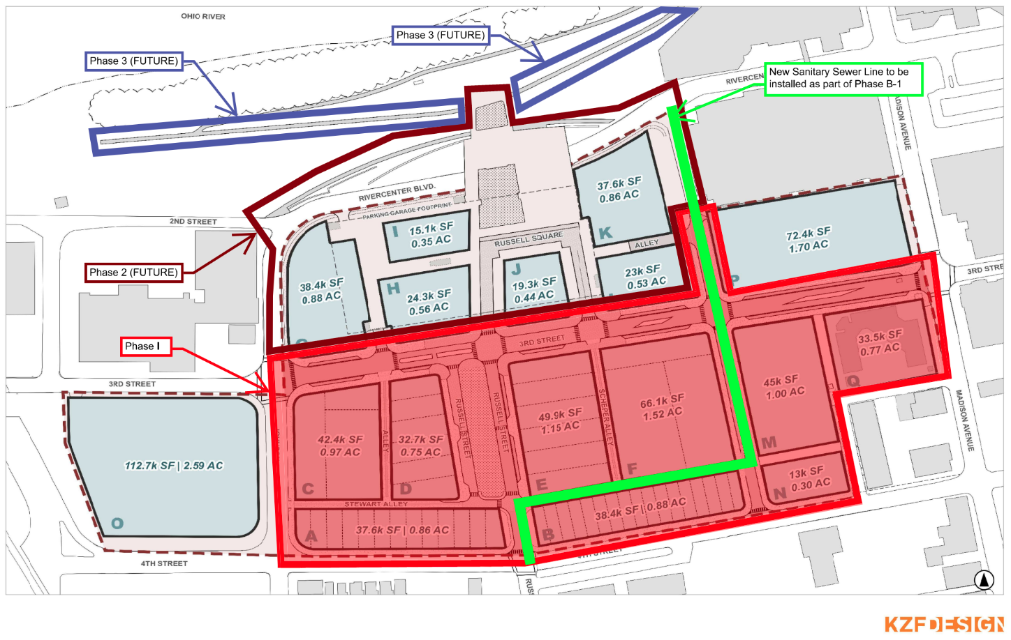
Site Plans
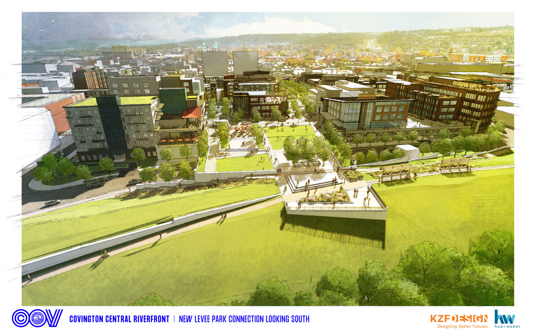
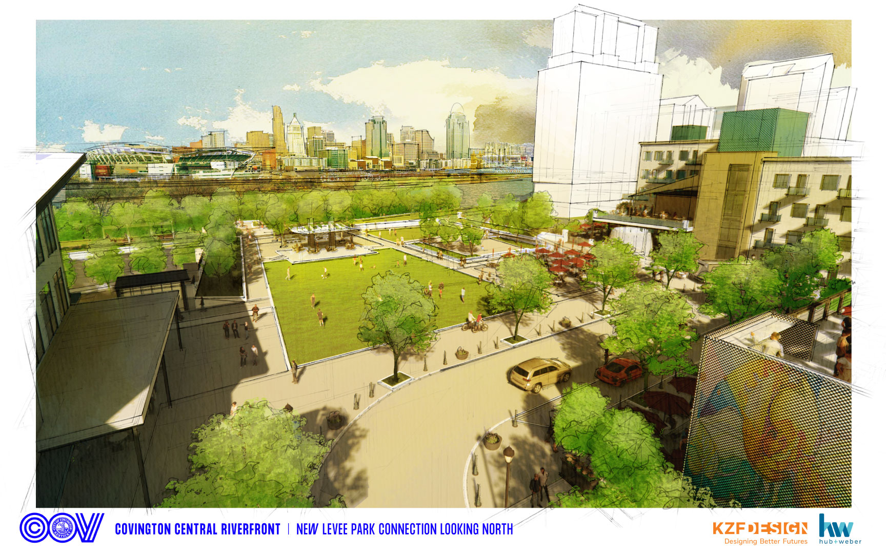
Artist Renderings
Development Objectives
The City has committed to this redevelopment district like none before with land acquisition, master planning, demolition, remediation, engineering utilities design, and horizontal infrastructure, including a 670-car public garage. This investment of effort, energy, time and treasure represents the commitment and dedication of the City’s elected and appointed officials and City staff to the progressive vision, which anticipates the development of this new mixed-use neighborhood with new jobs and significantly leveraged private investment. Development objectives include:
- A restored street grid
- A variety of developers
- A restored street grid
- Commitment to Covington developers
- Minority and Women owned participation
- Market rate housing
- 50–100-year life cycle of buildings
- Flexible public green spaces
- Pedestrian and bicycle oriented
- Office space with high paying jobs
- Locally owned retailers, restaurants, and bars
- Reasonable sale for parcels
Master Plan
The conceptual master plan and its supporting information can be seen in the links below.
Incentives
City investment – $100 million+
The City is investing more than $100 million for master planning, site acquisition, demolition, environmental remediation, design, engineering and construction of public infrastructure. This investment in the horizontal infrastructure includes utilities, public rights of way and spaces, roadways, alleys, parks, plazas, and a 670-space parking garage, and provides the private sector with a consistent and reliable environment, ensuring the feasibility of the real estate redevelopment of the site with creative projects by talented developers and entrepreneurs.
Federal Opportunity Zone
The site is located within a federally designated Opportunity Zone. Developers are encouraged to explore the benefits and formation of an Opportunity Zone Fund for qualified projects.
Active RFPs. Stay Connected
How do I receive notifications for the City of Covington’s competitive procurement opportunities, Invitations to Bid (ITB) and Requests for Proposals (RFP)?
Register for free as a vendor on Bonfire, the City’s competitive procurement portal, to receive notifications of ITB’s and RFP’s.
Fly Through
Click on the image below for an animated tour of the new neighborhood as imagined in the master plan.